
GeospatialTech Challenge 2021
GeospatialTech Challenge 2021 final presentation was held by the Lands Department on 30 Jun. I was fortunate to be invited as a guest. Here is a highlight of the event.
The main theme of the competition is proposal for improvement of community facilities with the use of geospatial data and other open data, thereby promoting smart living and a healthy lifestyle. There was totally 4 student teams and 3 open teams.
Student Group
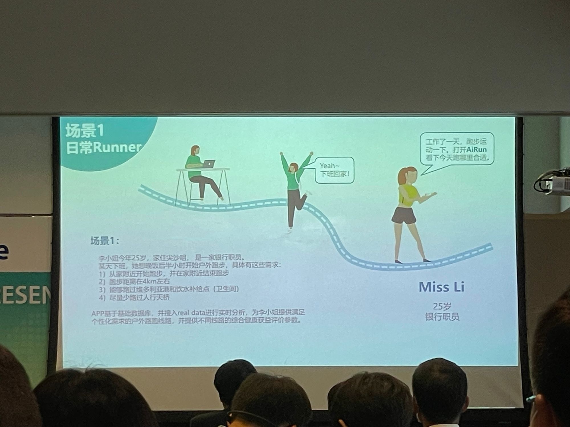
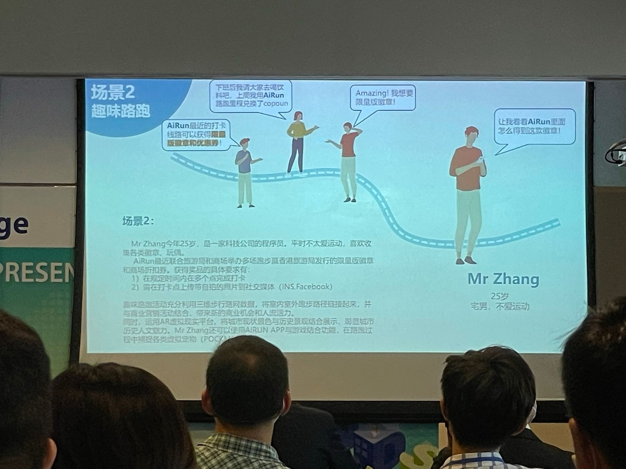
Team1: AIRUNNERS
Title: 健康稱心跑:AIRUN程式開發設計與應用設想
This proposal is base on the air quality project by HKUST called PRAISE HK. This app make use of the 3D Pedestrian Network from LandsD, public facilities data, traffic data, air quality data and land use data to plan for the route for street runners, based on their specific requirement.
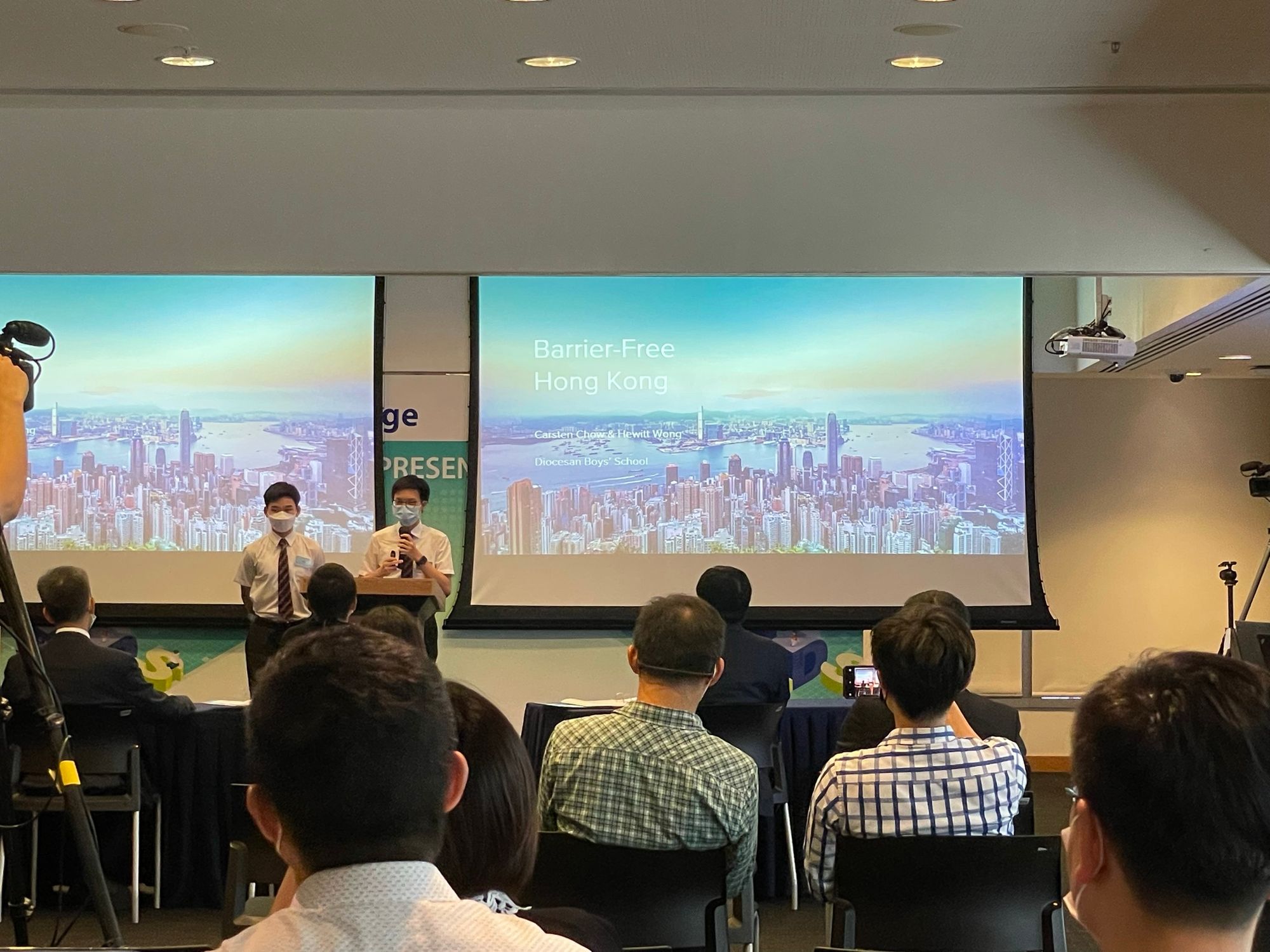
Team2:Diocesan Boys' School
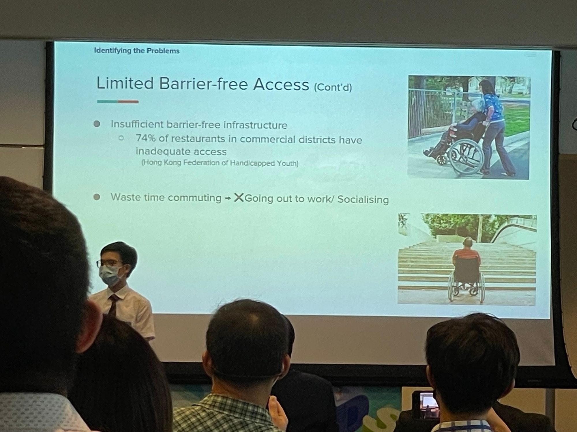
Title: Barrier-free Hong Kong
This study is based on the pain points about barrier-free access in Hong Kong, including limited barrier-free access, hilly terrain, insufficient geospatial data and sparse and often unavailable disabled parking spots. And propose solutions for that. This is a team formed by secondary school students but conducted a in depth analysis of the problem.
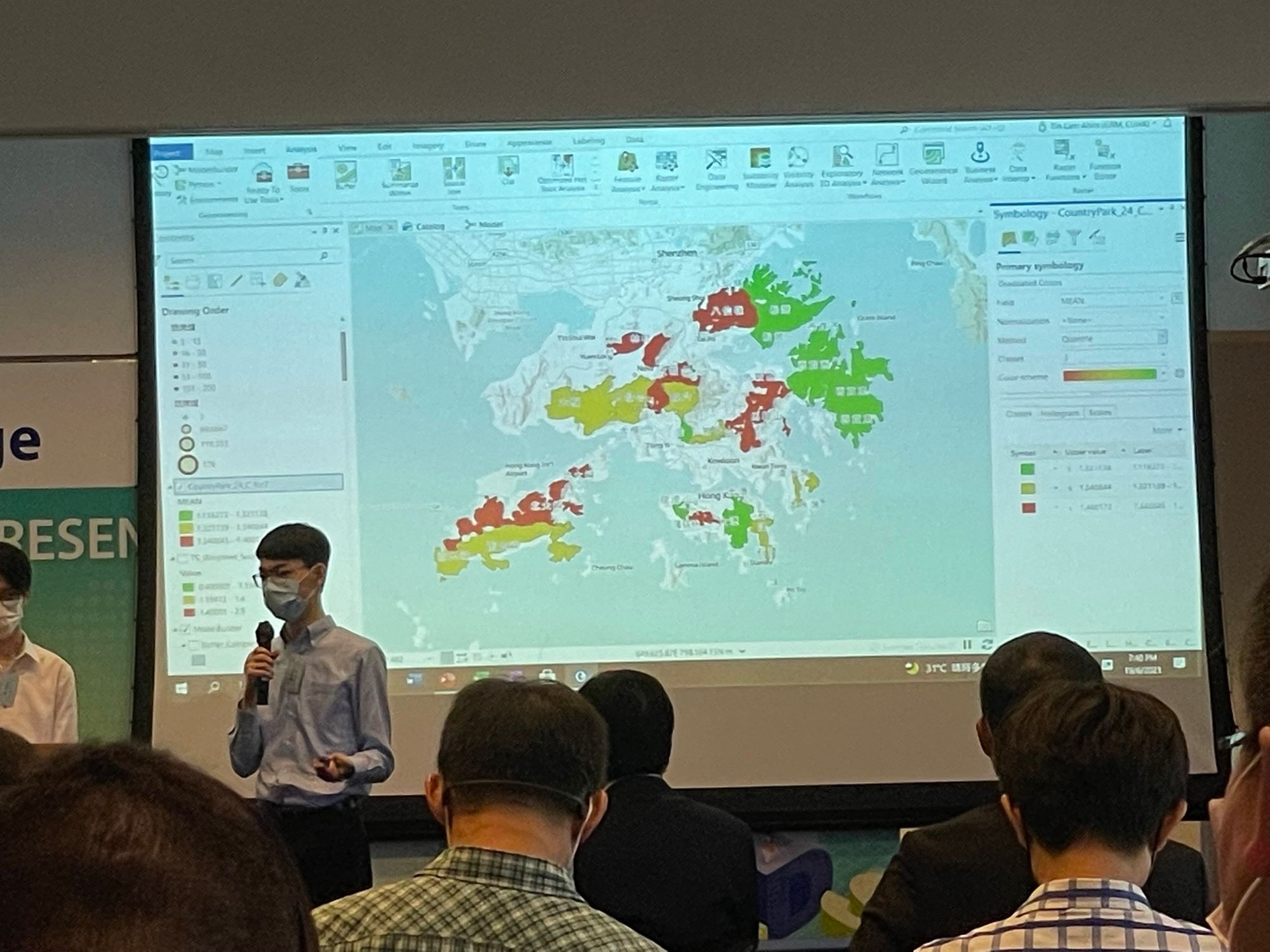
Team3: CUHK GRM
Title: 香港郊野公園火災危險警告 Hill Fire Alert System in Hong Kong Country Park
This app try to predict fire danger risk of different country parks base on real time data such as relative humidity together with slope, vegetation and aspect, and target to build a REST API for public use.
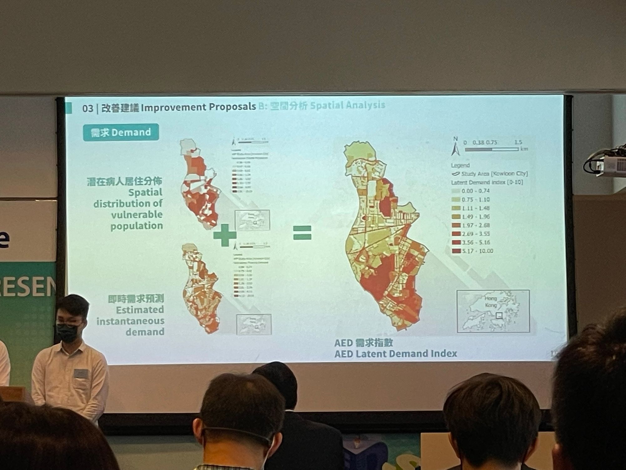
Team4: AED
Title: Addressing Emergency Demand Deriving a optimal placement and emergency management plan of Automatic External Defibrillators in HK
This team suggested a spatial analysis framework for matching the demand (based on demographic data), and supply of AED, and significantly improve the coverage of AED for saving human life.
Open Group
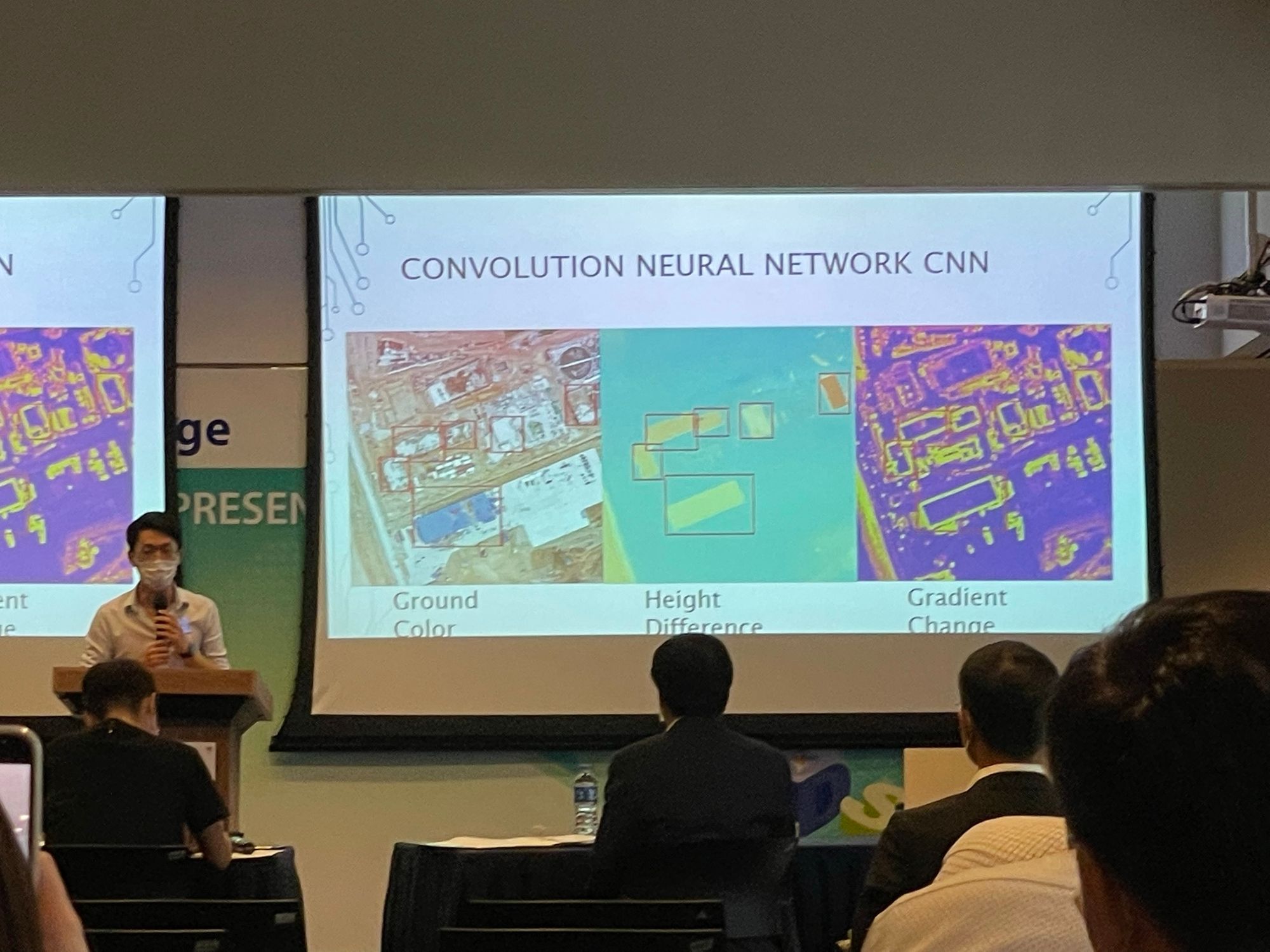
Team5: Varadise Limited
Title: Monitor Brownfield Sites and Unlawful Occupation of Government Land usage using 3D Photo-realistic model
This team developed a AI based geospatial analysis application using on convolution neural network, to identify unlawful occupation of Government Land usage.
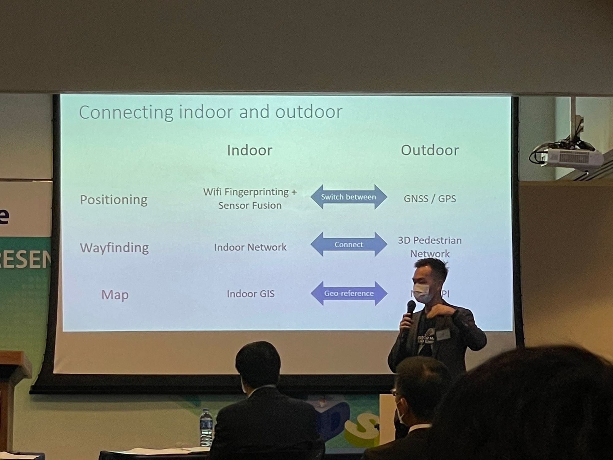
Team6: Maphive Technology Limited
Title: Integration of indoor-outdoor navigation to improve city-walkability
This team developed an application to combine indoor and outdoor GIS, using WIFI fingerprinting and sensor fusion for indoor positioning, and provide app for indoor outdoor navigation.
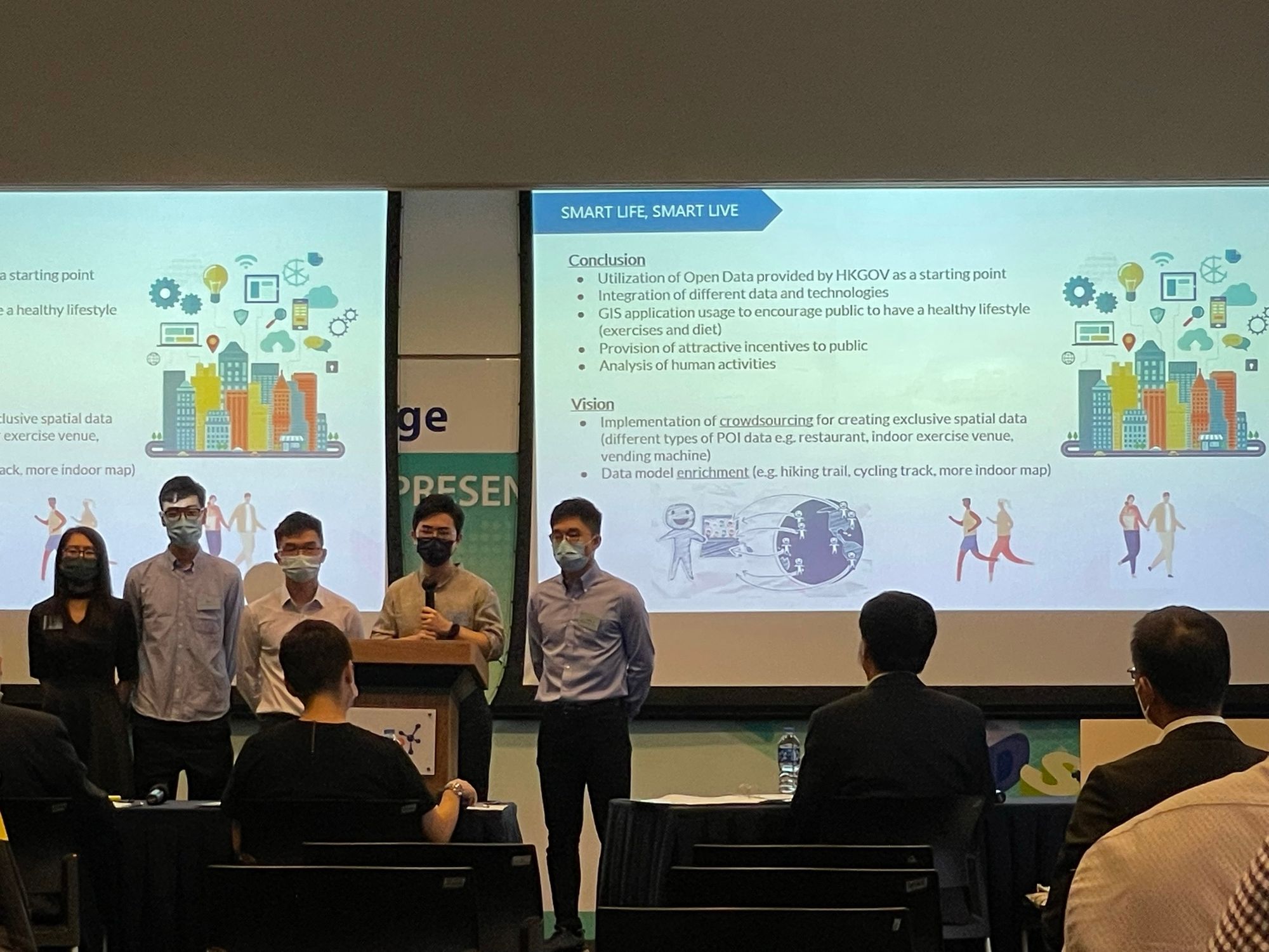
Team7: Smart Life, Smart Live
Title: Enhancement of smart mobility and public health through mobile application
This team developed app to track health of the users, and control calorie intake and consumption base on tracking the diet and exercise of the users.
For more information please visit the official site
