
Well•being Map
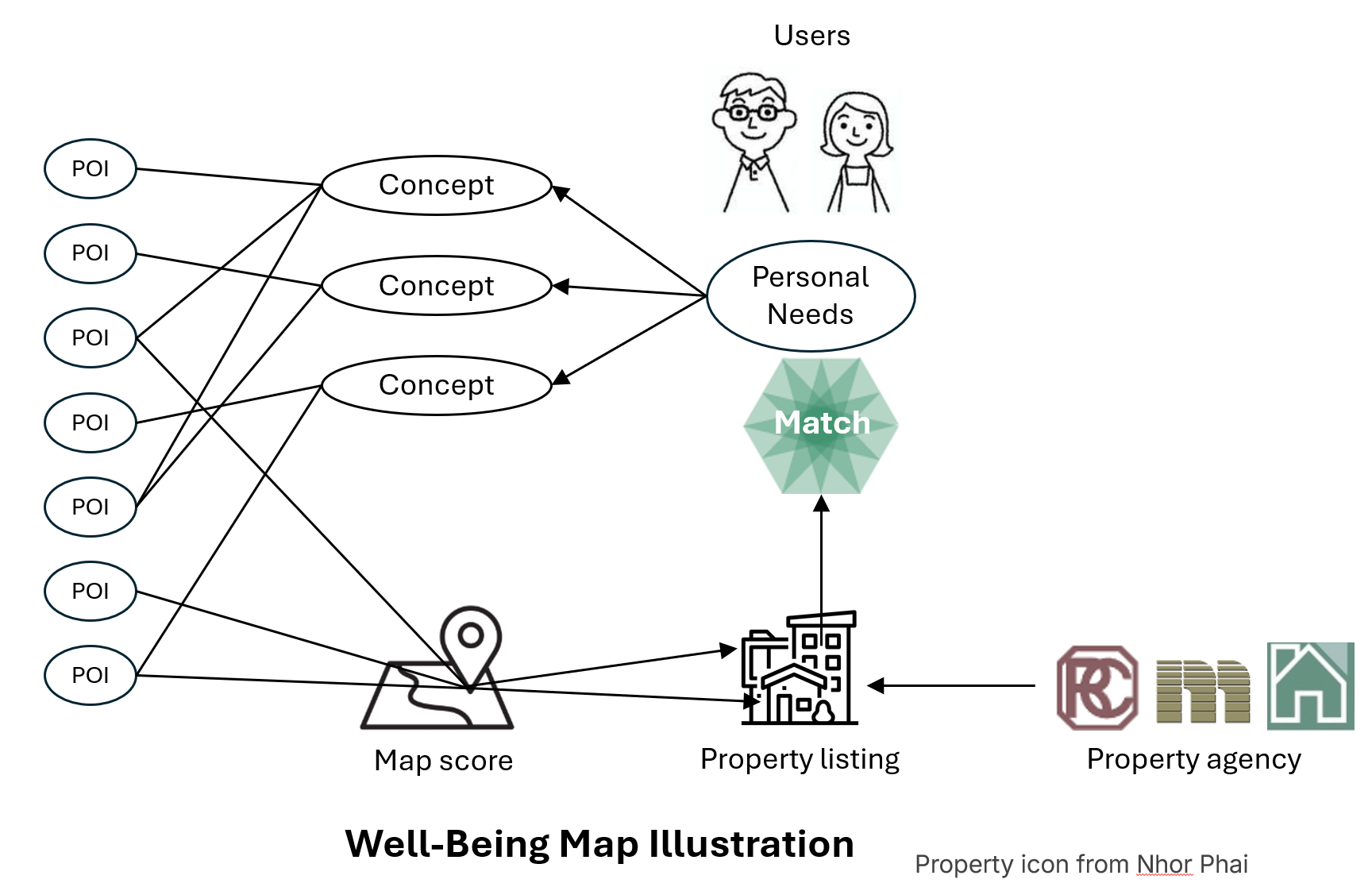
Inspired by the well-being design concepts proposed by the Housing Authority last year, Geospatial HK developed a web application call Well-being Map, where 12 concepts are calculated base on the open source POI data from CSDI portal and Open Street Map (OSM).
Website: https://wellbeingmap.org/
e.g. The concept 活躍好動 is calculated by the following formular with the counts of different POI within each 1 Hectare hexagon covering Hong Kong.
4 * csdi_cycsite + 1 * osm_drinking_water + 2 * osm_picnic_site + 3 * osm_bicycle_shop + 1 * osm_camp_site + 4 * osm_sports_centre + 3 * osm_sports_shop + 3 * osm_bicycle_rental + 3 * osm_swimming_pool + 2 * osm_stadium + 6 * csdi_hiking_trailsIt assumed that the citizen preferring this concept will also prefer living in the area with higher score of this concept.
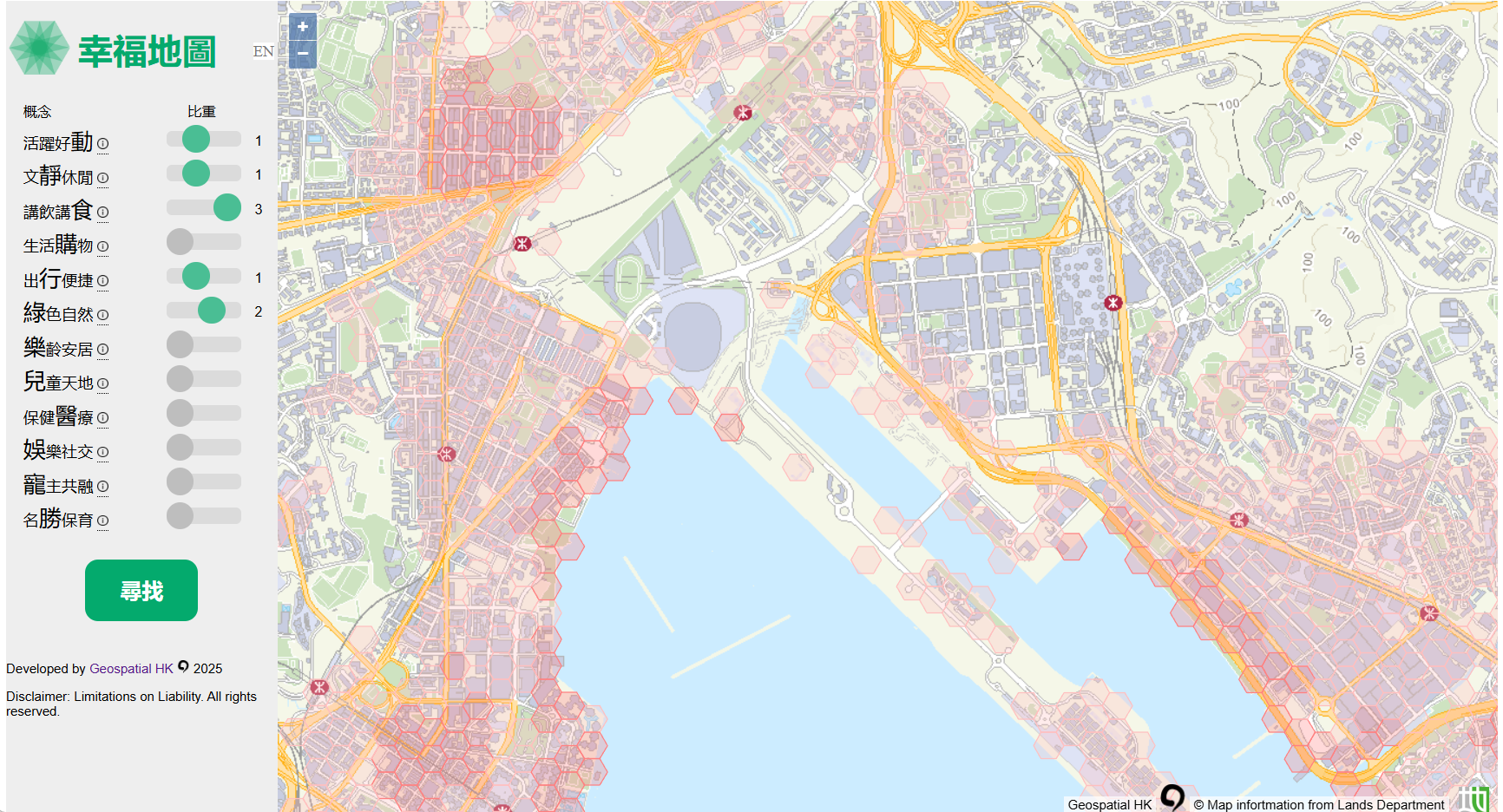
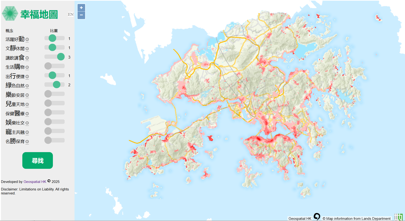
The most interesting thing for this application is users can overlay different concepts with their preferred weight, and the map engine will calculate score of each hexagon base on the combined weight of different concepts in it. It mimics the raster overlay analysis in GIS software. (https://desktop.arcgis.com/en/arcmap/latest/analyze/commonly-used-tools/overlay-analysis.htm)
Through this process users can understand their real needs, and locate the areas in the city that are suitable to them.
E.g. If user prefers more on food (restaurant and market), he or she can put more emphasize on 講飲講食 concept, following by the natural environment concept (綠色自然), with some emphasize on 活躍好動, 文靜休閒, 出行便捷. And then the application will display the map which meet his or her personal needs.

The advanced version is under development, where users can define their own concepts with the formula they prefer, and more POI data set will be provided later. There will be also attempt to match the properties in the area calculated based on their personal needs, and with the highest CP value for them.
Thanks.